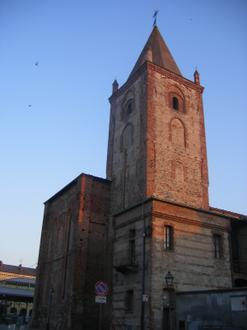
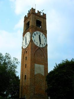
Negocis a Sant'Albano Stura
Hotels i Viatges
Restaurants
Automoció
Serveis Financers
Mèdic
Centres de Bellesa i Spas
Govern i Comunitat
Indústries
Distribució comercial per indústria Compres: 18,4 %
indústria: 18 %
Menjar: 9,7 %
Restaurants: 9,4 %
Serveis per a la Llar: 7,9 %
Serveis professionals: 7,9 %
Automoció: 5,2 %
Altres: 23,6 %
| Àrea de Sant'Albano Stura, Piemont | 28,1 km² |
| Població | 1.575 |
| Població masculina | 816 (51,8 %) |
| Població femenina | 759 (48,2 %) |
| Canvi de població del 1975 al 2015 | +62 % |
| Canvi de població del 2000 al 2015 | +20,6 % |
| Edat mitjana | 36,8 |
| Edat mitjana homes | 37 |
| Dona d'edat mitjana | 36,6 |
| Hora local | dijous 1:58 |
| Zona horària | Hora d’estiu del Centre d’Europa |
| Lat. i lon. | 44.50759° / 7.72282° |
Sant'Albano Stura, Piemont - Mapa
Població de Sant'Albano Stura, Piemont
De l'any 1975 al 2015| Dades | 1975 | 1990 | 2000 | 2015 |
|---|---|---|---|---|
| Població | 972 | 1.175 | 1.306 | 1.575 |
| Densitat de població | 34,6 / km² | 41,8 / km² | 46,5 / km² | 56,0 / km² |
Canvi de població del 2000 al 2015 a Sant'Albano Stura
Increment del 20,6 % de l'any 2000 al 2015| Ubicació | Canvis des de l'any 1975 | Canvis des de l'any 1990 | Canvis des de l'any 2000 |
|---|---|---|---|
| Sant'Albano Stura, Piemont | +62 % | +34 % | +20,6 % |
| Cuneo | +14,3 % | +8 % | +6,2 % |
| Itàlia | +8,3 % | +4,9 % | +4,7 % |
Mitjana d'edat de Sant'Albano Stura, Piemont
Mitjana d'edat: 36,8 anys| Ubicació | Edat mitjana | Edat mitjana (dona) | Edat mitjana (masculí) |
|---|---|---|---|
| Sant'Albano Stura, Piemont | 36,8 anys | 36,6 anys | 37 anys |
| Cuneo | 41,4 anys | 41,7 anys | 41,1 anys |
| Itàlia | 40,9 anys | 41,5 anys | 40,3 anys |
Arbre de població per a Sant'Albano Stura, Piemont
Població per edats i gènere| Edat | Home | Dona | Total |
|---|---|---|---|
| Menors de 5 anys | 54 | 74 | 128 |
| 5-9 | 39 | 44 | 84 |
| 10-14 | 38 | 34 | 72 |
| 15-19 | 42 | 37 | 79 |
| 20-24 | 45 | 30 | 75 |
| 25-29 | 77 | 57 | 135 |
| 30-34 | 85 | 80 | 166 |
| 35-39 | 70 | 73 | 144 |
| 40-44 | 69 | 51 | 120 |
| 45-49 | 72 | 79 | 151 |
| 50-54 | 61 | 50 | 112 |
| 55-59 | 46 | 40 | 87 |
| 60-64 | 66 | 46 | 112 |
| 65-69 | 25 | 30 | 55 |
| 70-74 | 28 | 34 | 62 |
| 75-79 | 0 | 0 | 0 |
| 80-84 | 0 | 0 | 0 |
| 85 Plus | 0 | 0 | 0 |
Densitat de població de Sant'Albano Stura, Piemont
Densitat de població: 56,0 / km²| Ubicació | Població | àrea | Densitat de població |
|---|---|---|---|
| Sant'Albano Stura, Piemont | 1.575 | 28,1 km² | 56,0 / km² |
| Cuneo | 591.928 | 6.898,2 km² | 85,8 / km² |
| Itàlia | 59,3 milions | 301.510,7 km² | 196,7 / km² |
Població històrica de Sant'Albano Stura, Piemont
Població estimada de l'any 900 al 2015Sources:
1. JRC (European Commission's Joint Research Centre) work on the GHS built-up grid
2. CIESIN (Center for International Earth Science Information Network)
3. [Enllaç] Klein Goldewijk, K., Beusen, A., Doelman, J., and Stehfest, E.: Anthropogenic land use estimates for the Holocene – HYDE 3.2, Earth Syst. Sci. Data, 9, 927–953, https://doi.org/10.5194/essd-9-927-2017, 2017.
Índex de desenvolupament humà (HDI)
Índex compost estadístic de l'esperança de vida, l'educació i la renda per càpita.Sources: [Link] Kummu, M., Taka, M. & Guillaume, J. Gridded global datasets for Gross Domestic Product and Human Development Index over 1990–2015. Sci Data 5, 180004 (2018) doi:10.1038/sdata.2018.4
Emissions de CO2 a Sant'Albano Stura, Piemont
Emissions de diòxid de carboni (CO2) per càpita en tones a l'any| Ubicació | Emissions de CO2 | Emissions de CO2 per càpita | Intensitat d'emissions de CO2 |
|---|---|---|---|
| Sant'Albano Stura, Piemont | 12.776 t | 8,11 t | 454,7 t/km² |
| Cuneo | 4.800.813 t | 8,11 t | 696 t/km² |
| Itàlia | 399.008.504 t | 6,73 t | 1.323 t/km² |
Emissions de CO2 a Sant'Albano Stura, Piemont
| Emissions de CO2 l'any 2013 (tones/any) | 12.776 t |
| Emissions de CO2 l'any 2013 (tones/any) per capita | 8,11 t |
| Intensitat d'emissions de CO2 l'any 2013 (tones/km²/any) | 454,7 t/km² |
Riscos naturals
Risc sobre 10| Inundació | Alt (8) |
| Terratrèmol | Mitjana (4) |
* El risc, sobretot pel que fa a inundacions o esllavissades de terra, pot no ser de tota la zona.
Sources: 1. Dilley, M., R.S. Chen, U. Deichmann, A.L. Lerner-Lam, M. Arnold, J. Agwe, P. Buys, O. Kjekstad, B. Lyon, and G. Yetman. 2005. Natural Disaster Hotspots: A Global Risk Analysis. Washington, D.C.: World Bank. https://doi.org/10.1596/0-8213-5930-4.
2. Center for Hazards and Risk Research - CHRR - Columbia University, Center for International Earth Science Information Network - CIESIN - Columbia University. 2005. Global Flood Hazard Frequency and Distribution. Palisades, NY: NASA Socioeconomic Data and Applications Center (SEDAC). https://doi.org/10.7927/H4668B3D.
3. Center for Hazards and Risk Research - CHRR - Columbia University, Center for International Earth Science Information Network - CIESIN - Columbia University. 2005. Global Earthquake Hazard Distribution - Peak Ground Acceleration. Palisades, NY: NASA Socioeconomic Data and Applications Center (SEDAC). https://doi.org/10.7927/H4BZ63ZS.
Terratrèmols propers recents
Magnitud 3.0 i superior| Data | Hora | Magnitud | Distància | Profunditat | Ubicació | Enllaç |
|---|---|---|---|---|---|---|
| 3/10/12 | 2:20 | 4,5 | 33,5 km | 10.000 m | northern Italy | usgs.gov |
| 19/4/09 | 5:39 | 4,5 | 26,2 km | 40.200 m | northern Italy | usgs.gov |
| 23/10/08 | 20:06 | 4,5 | 34,4 km | 5.000 m | northern Italy | usgs.gov |
| 11/9/06 | 8:04 | 3,6 | 12,1 km | 55.400 m | northern Italy | usgs.gov |
| 25/3/05 | 15:19 | 3,9 | 31,7 km | 10.300 m | northern Italy | usgs.gov |
| 20/11/04 | 10:25 | 3,2 | 31,4 km | 10.000 m | northern Italy | usgs.gov |
| 2/3/04 | 1:23 | 3,1 | 30,1 km | 14.700 m | northern Italy | usgs.gov |
| 1/9/03 | 12:28 | 4 | 35,8 km | 1.900 m | northern Italy | usgs.gov |
| 20/7/03 | 7:40 | 3,2 | 27,4 km | 11.000 m | northern Italy | usgs.gov |
| 10/6/03 | 15:59 | 4,2 | 31,5 km | 19.900 m | northern Italy | usgs.gov |
Troba els terratrèmols històrics registrats a Sant'Albano Stura, Piemont
Data més antiga Última data
Magnitud 3.0 i superior Magnitud 4.0 i superior Magnitud 5.0 i superior


Sobre les nostres dades
Les dades d'aquesta pàgina es calculen amb diverses eines i recursos disponibles al públic. Es proporciona sense garantia i pot contenir inexactituds. Utilitzeu el vostre propi risc. Consulteu aquí per obtenir més informació.